Today was an all-day excursion, and once we entered Petra, we were on our own.
 |
| Along the first half-mile section were minor tombs cut into sandstone; earthquakes in 363 and 551 destroyed much of the city and it was abandoned by the 7th century |
 |
| The Djinn Blocks are three cubic monuments, which may have been tombs, but their purpose is unknown; djinn is Arabic for spirit |
 |
| Looking back to see all three blocks |
 |
| Next to the Djin Blocks is an unfinished tomb and a tomb with a stepped façade |
 |
| The Snake Tomb |
 |
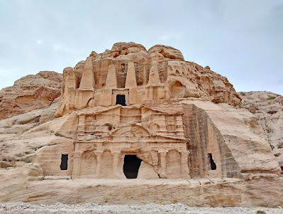
| Above is the Obelisk Tomb with four nefeshes/pointed pillars, not true obelisks, and below is the triclinium/dining room for ritual banquets in honor of the deceased |
 |
| The Nabataean dam and bridge was reconstructed to continue its function of diverting flash floods away from the Siq into a neighboring wadi/valley, in this case a gorge |
 |
| The dam blocked the entrance to the Siq/shaft, the passage toward the left, and the water passed under the bridge to run toward the right |
 |
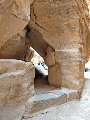
| The Nabataeans dug a tunnel for the water to pass through to the next gorge |
 |
| The entrance to the Siq, a slot canyon formed by tectonic forces at a fault, and later smoothed by flooding waters |
 |
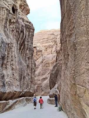
| The walls of the Siq stand 91-182 m/ 299-597' tall and it runs for 1.2 km/0.75 mile |
 |
| This is the south-side base of the arch that crossed over the entrance to the Siq; the votive niche would have held a figure of the reigning gods of the time |
 |
| The stone walls were veined, likely with manganese |
 |
| Fascinating shapes in the gorge |
 |
| In some places the Siq is only 3 m/10' wide |
 |
| Once the entire length of the Siq had man- made water channels running on both sides |
 |
| Another votive niche where the six small pillars at the top are interpreted as betyls/sacred stones |
 |
| Section of original paving in the Siq |
 |
| A boulder carved with a relief designed like a temple gate, in which are carved two betyls (difficult to see unless you note the bases of the betyls behind the fence) |
 |
| An interesting geologic formation |
 |
| A narrow shortcut |
 |
| Aww, puppies! |
 |
| Sandstone in red, black, and yellow |
 |
| Sabinos Alexandros Station, a row of votive niches, some with Greek inscriptions indicating they were created after the Nabataean period; the "station" is named for one of the donors mentioned by name |
 |
| We figured we were taking a photo of the lower half of a man, but did not realize that next to him were the feet of a camel! |
 |
| A fig tree |
 |
| At last, the end of the Siq |
 |
| Called the Al-Khazneh/the Treasury, this is actually a mausoleum cut into the rock cliff (or diod it have another purpose?) |
 |
| Now we follow another wadi, past Bedouin vendors, including one using a mini-blower to dust his wares |
 |
| The Street of Façades with a row of tombs, one after another; including the Treasury, all of these tombs were once covered with stucco and painted |
 |
| Someone has turned one of the tombs into the "Starbucks Cave" |
 |
| This tomb has been carved on three sides; this façade is topped by crow-steps |
 |
| The whole area of Petra was filled with debris from earthquakes and floods, and these façades are still half-buried |
 |
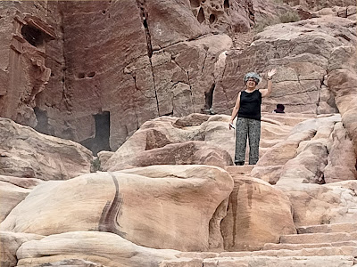
| The Theater Necropolis has smaller tomb façades; here Kent waited with a pal while I attempted the trail to the High Place of Sacrifice |
 |
| Looking back down at the half-buried tombs, and noting the sandy-dust covered solar panels |
 |
| I probably should have taken a donkey up the steep trail, since I made the mistake of bringing nothing but my camera |
 |
| Now looking down at the Theater Necropolis |
 |
| Okay, I was severely dehydrated with shaky legs, and knew I had to return |
 |
| Yes, I came back down without finding the sacrificial platform with carved channels to drain the blood of sacrificial animals |
 |
| High on the opposite cliff is the Uneishu Tomb in Hegra-style, with a [reverse] stepped gable and double cornices |

No comments:
Post a Comment